Aspen Draw
Length: 1.7 – 2.7 miles (one way)
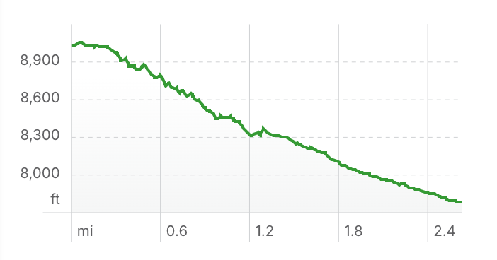
Elevation Gain: -1,077 ft (downhill)
Overview
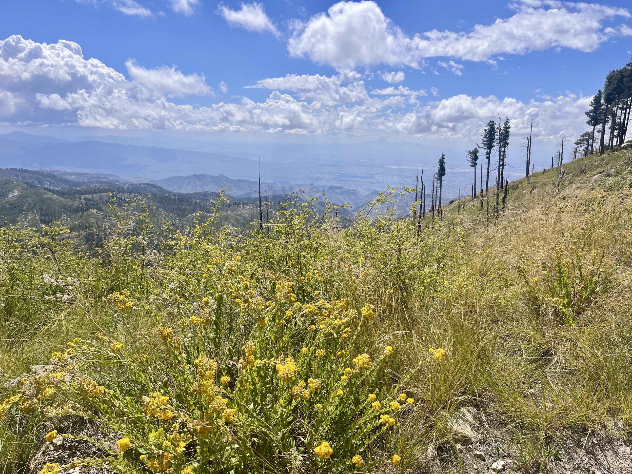
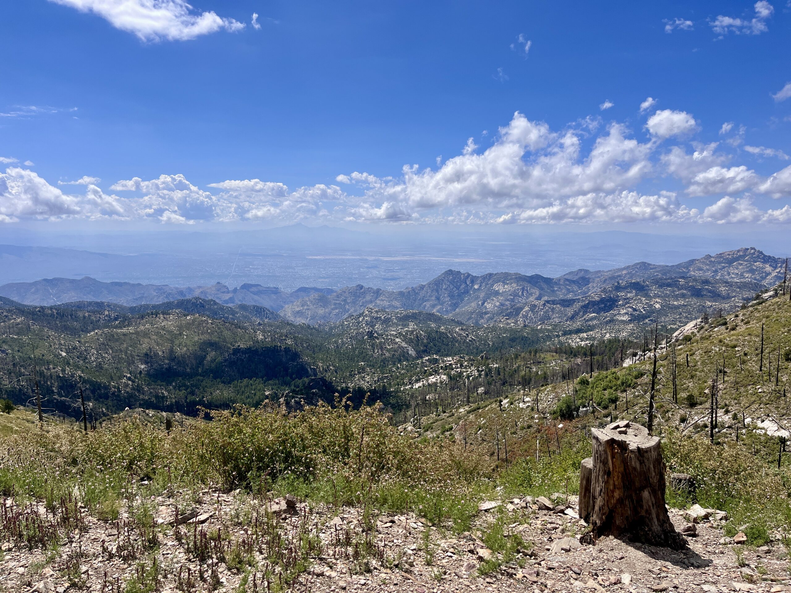
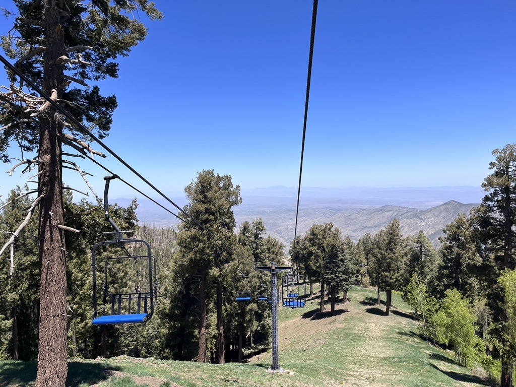
Can’t get much higher on Mount Lemmon than the start of Aspen Draw. This ride offers gorgeous 360 degree views and shifts into a cruisy downhill ride through a stand of Douglas Fir to the town of Summerhaven.
Note: The Aspen Draw ride starts near the end of Ski Run Road. Ski Run Road is closed annually from December 15 to March 1, with the closure sometimes being extended into April if winter conditions persist.
Ride Options
Two-Vehicle, One-Way Ride: Some bikers take Aspen Draw as a downhill, one-way trip, staging a car where they plan to end their ride. One option is to ride from Aspen Draw Trailhead and finish at the Mount Lemmon Ski Valley Parking Area (1.7 miles). A second option is to continue down to the town of Summerhaven and end at the Mount Lemmon Community Center (2.7 miles). Parking at Mount Lemmon Ski Valley is plentiful; however, parking in town may be more difficult to find.
One-Vehicle, Out-and-Back: If you only have one car, you will need to bike up Ski Run Road to return to your vehicle via the paved Ski Run Road from the Mount Lemmon Ski Valley Parking Area (3.2 miles) or the Mount Lemmon Community Center (5.9 miles).
Driving Directions to Aspen Draw Trailhead (Start)
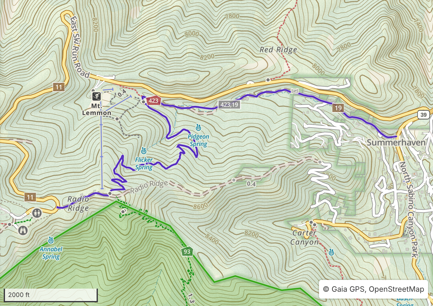
From Palisades Visitor Center continue up Catalina Highway towards Summerhaven for 4.5 miles and make a right on Ski Run Road. (If you arrive in Summerhaven you’ve gone too far.) Follow Ski Run Road for 3.0 miles, passing Mount Lemmon Ski Valley, and winding upward toward the top of the mountain. On the last switchback just before reaching the top parking lot, you’ll see a parking lot on your left and a sign with a large left arrow that says “Summit Trails.” Park here. Parking can be crowded at all lots on weekends. The ride begins on the east side of the parking lot, following Radio Ridge Road.
Driving Directions to Mount Lemmon Ski Valley (end)
From Palisades Visitor Center continue up Catalina Highway towards Summerhaven for 4.5 miles and make a right on Ski Run Road. (If you arrive in Summerhaven you’ve gone too far.) Follow Ski Run Road for 1.4 miles to Mount Lemmon Ski Valley. You’ll see the Iron Door Restaurant on your right and parking is available on either side of the road.
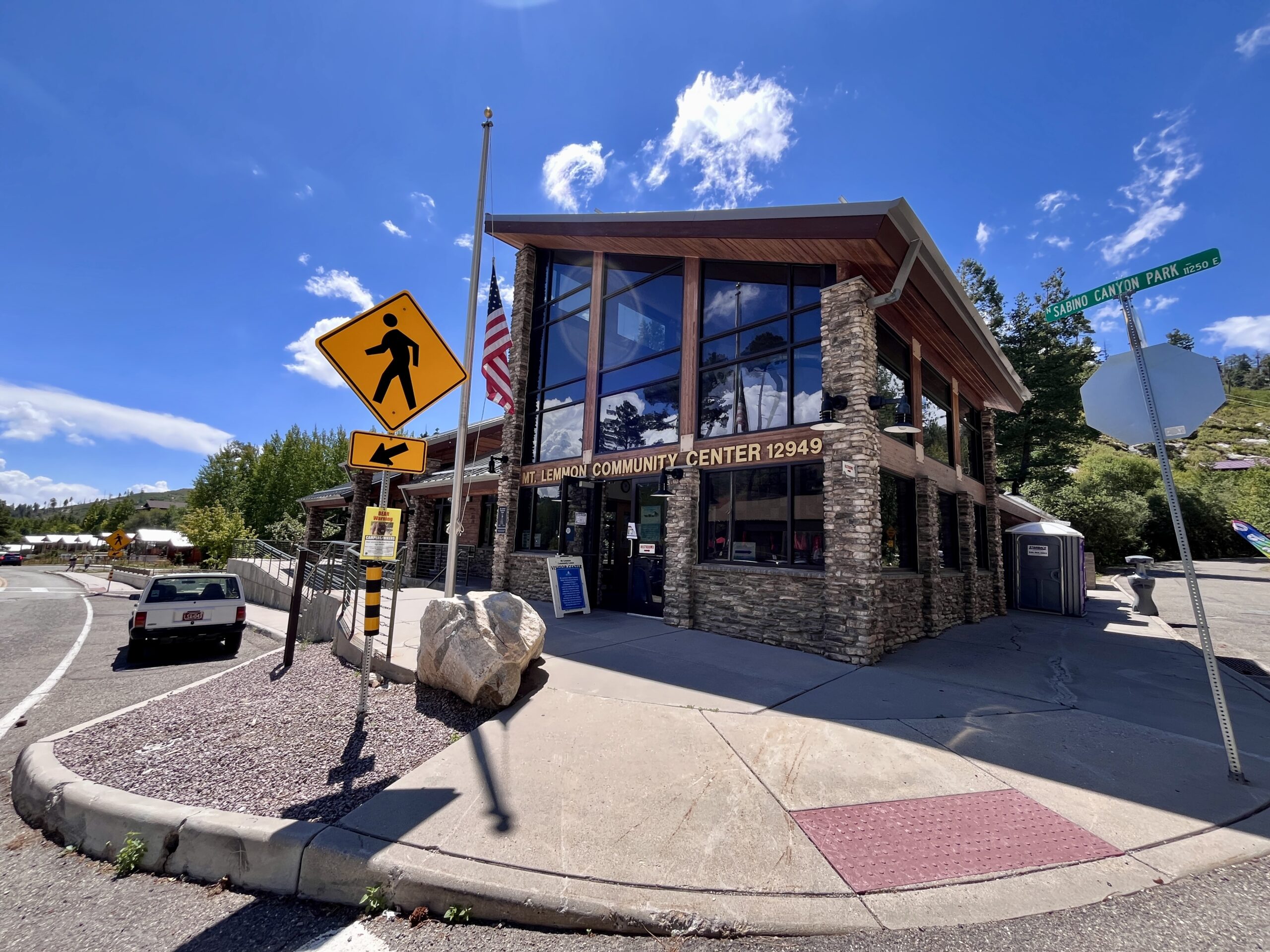
Driving Directions to Mount Lemmon Community Center (end)
From Palisades Visitor Center continue up Catalina Highway for 4.6 miles. You’ll pass Ski Run Road on your right and enter the town of Summerhaven soon after. Right as you enter the town of Summerhaven you’ll see the community center on your right. Parking is available throughout town, but may be tough to find on weekends. Please pay attention to signage.
Ride Overview
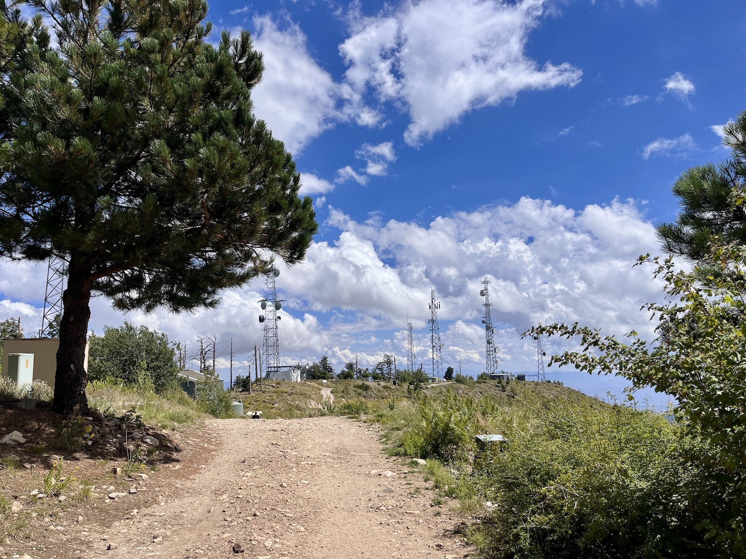
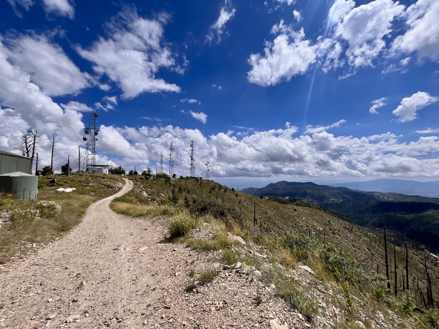
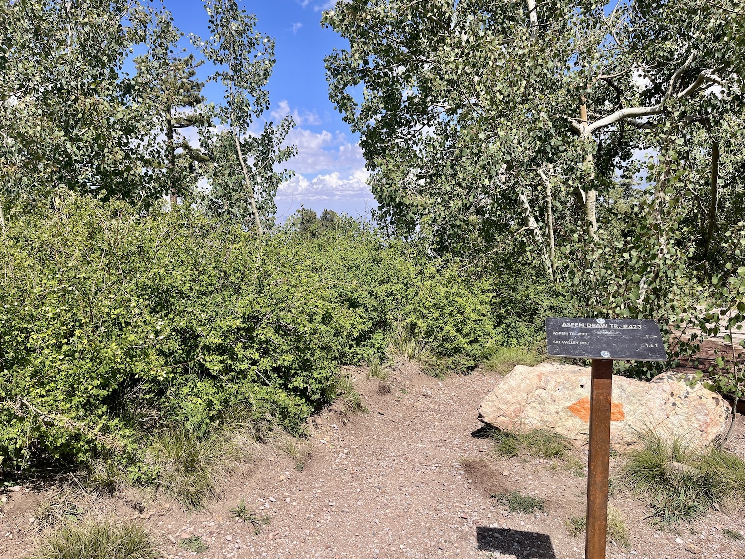
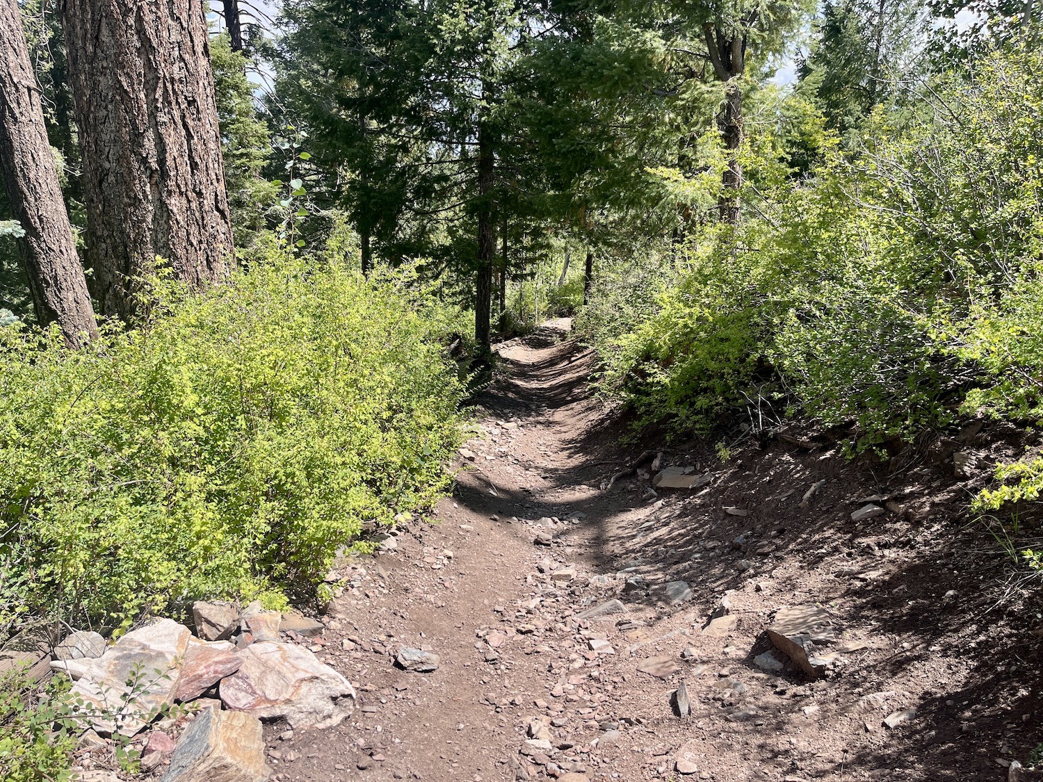
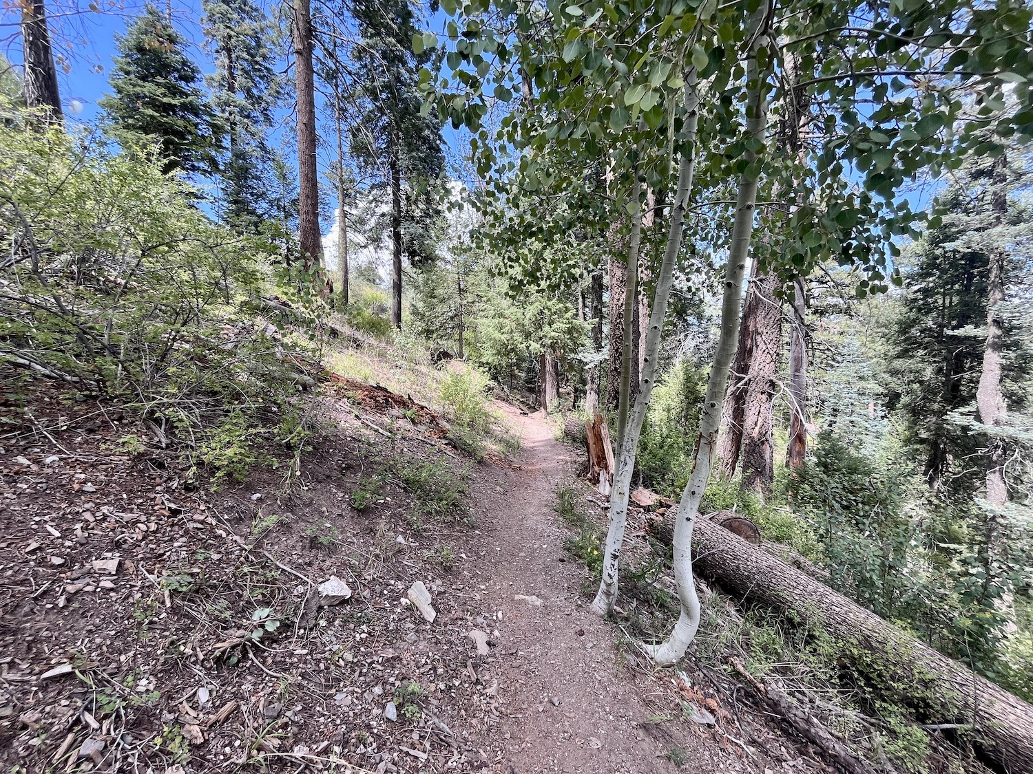
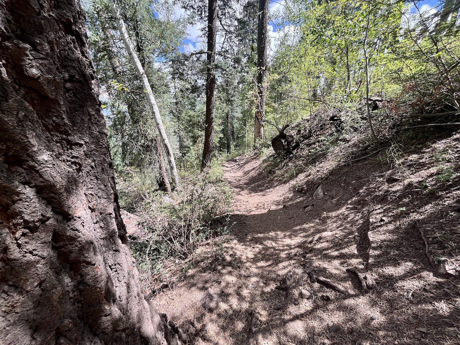
From the parking lot, follow Radio Ridge Road (behind the gate) until you reach the top of the Mount Lemmon Ski Lift. Don’t forget to enjoy the view! Just past the ski lift, there is a small shack with radio towers. Here, the Aspen Drawn Trail #423 will leave the road to the left. There is a small trail sign. This is where you’ll start your descent. The trail is technical and switchbacks down the mountain just east of the ski lift through a grove of large Douglas Firs and Aspen. Please beware of other trail users.
At 1.5 miles, you’ll see a trail junction to the left. This will take you to the Ski Valley parking area, and the bottom of the ski hill. If this is where you parked a second vehicle, take the left here.
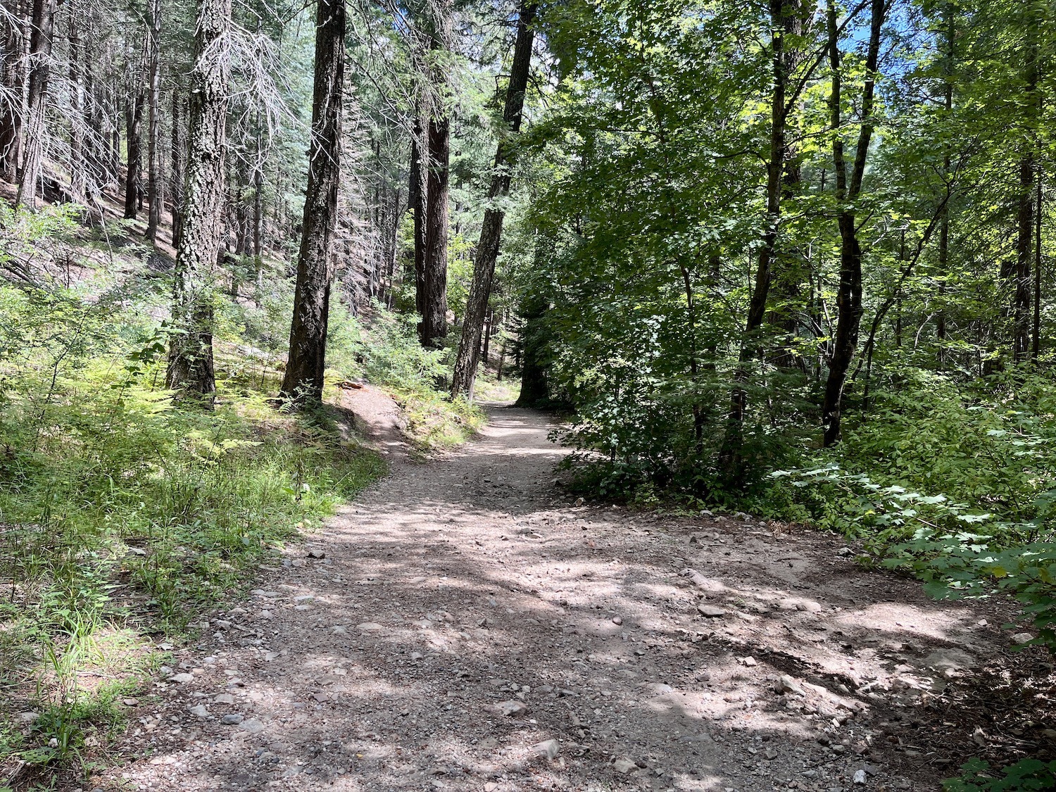
If you parked a second vehicle in Summerhaven, continue to the right and down the mountain. This trail will cross Sabino Creek several times and soon turn into Turkey Run Road, which is open to motorized vehicles. As it descends, you’ll pass into a neighborhood before finally ending in Summerhaven just north of the Mount Lemmon Community Center.
Safety
This trail is open to both mountain bikers and hikers, please use caution and be courteous to other users you are likely to meet on the trail.
At Aspen Draw Trailhead, DO NOT go beyond the gate, even if the gate is open. Radio Ridge Road is for authorized use only and your vehicle may be locked in.
If you only have one vehicle or plan to bike back up Ski Run Road for multiple runs, please use caution. This road is narrow with blind turns.
The mileage and elevation profile for this ride is one-way. Please make arrangements to get back to your vehicle, or be prepared for the climb back to your car.
Be sure to visit the Know Before You Go page for additional safety information.